
Greece · Epirus, Souli · Premium route guide
Paramythia Pass, Epirus
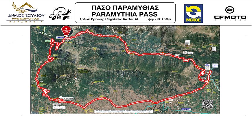
The first pass on Greece's national register. A 70 km loop from the Voulgaris School-Museum in Paramythia, across the Kokytos and Acheron plain, up through the mountains of Souli to a 1,180 m viewpoint and home through fir forest.
- Distance
- 70 km
- Peak elevation
- 1,181 m
- Elevation gain
- 2,675 m
- Best months
- All year
The route
The flagship of the three passes in the Municipality of Souli, officially registered by the Hellenic Motorcycle Federation (MOT.O.E.) with national register number 1. It is a high-altitude pass of historic interest.
Starting and finishing at the Voulgaris School-Museum in Paramythia, this 70 km loop combines mountain riding with nature and some of the most important historic and cultural sites of the region. Surface is 95% asphalt and 5% concrete.
Works with Garmin, TomTom, BMW Navigator, Calimoto, Kurviger, komoot, MyRouteApp. Import as a track to ride the exact line. Road data from OpenStreetMap (ODbL); elevation from SRTM.
Track vs. route, how to load this into your GPS
What you are downloading is a GPX track, a dense, road-snapped breadcrumb of the exact line, with elevation on every point. It is not a GPX route (a short list of turn waypoints your device re-plans between). Tracks preserve our road choice; routes let the device pick its own way and can send you down a boring motorway shortcut.
How to use it on your navigator:
- BMW Navigator / Garmin Zumo / zumo XT: import as a track, then Convert to Route (or Trip Planner, new trip from track) if you want turn by turn prompts. Keep Recalculation off so it stays on our line.
- TomTom Rider: import the GPX in MyDrive, it loads as a track / itinerary. Enable Follow the exact route so it does not re-plan.
- Calimoto: open the GPX and choose Import as tour, Calimoto follows the track line.
- Kurviger / komoot / MyRouteApp: open the GPX and pick Import as track to keep the road choice. Only choose Import as route if you want the app to re-plan for your bike profile.
- Google Maps / Apple Maps: these do not read GPX. Use the map on this page for turn cues, or import the file into a GPX capable app first.
Rule of thumb: if your device asks "track or route?", pick track to ride our exact line, pick route only if you want the device to re-plan.
Elevation profile
From ~30 m at the base to 1,181 m at the top, 2,675 m of total climbing across the route.
From Paramythia the route heads south-east across the plain of the Kokytos and the Acheron. At Glyki it meets the Acheron and its springs: crystal water, a unique landscape and boat trips on the mythical river.
From Glyki the road climbs into the historic mountains of Souli. At around km 33 you can turn off to the Mill of Souli, a restored and visitable monument. At km 35 a turn leads to the historic site of Souli, with the Wells and the Council House of the Souliotes, and on to the Kiafa castle.
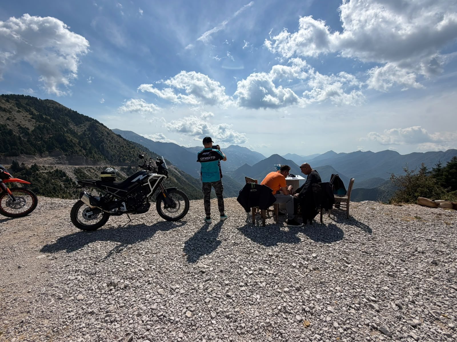
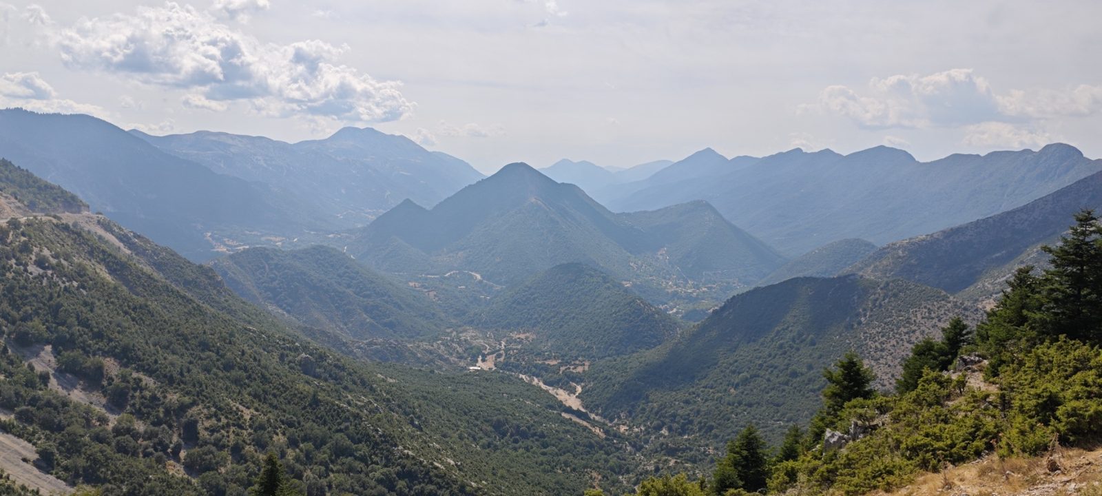
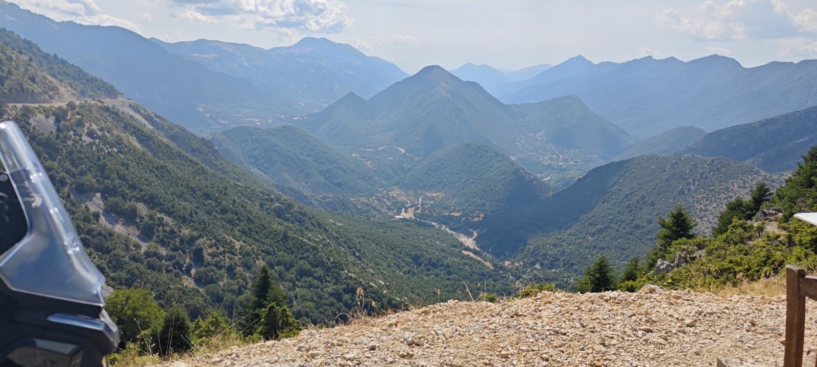
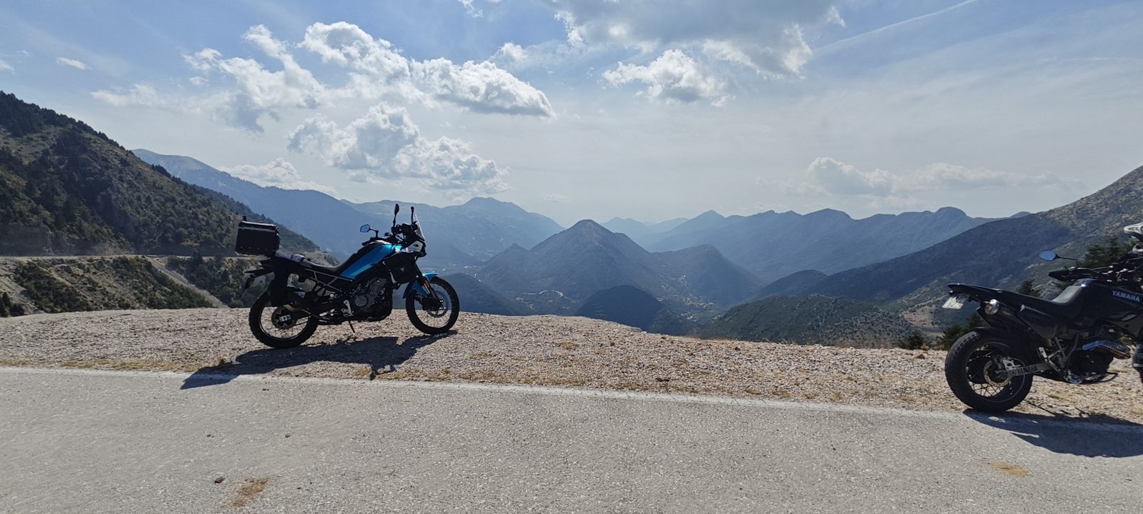
At km 51, at about 1,180 m, is the stop, rest and viewpoint, with a panorama over the villages of Souli and the fir forest. The return to Paramythia descends through the fir forest and ends back at the Voulgaris School-Museum, where the myths, history and nature you met on the road are told.
Ride it responsibly
The Municipality of Souli has published a guide to responsible riding on its motorcycle passes. Keep to the tarmac, respect the protected areas and the forest, and carry a layer, the viewpoint is at 1,180 m. Links: [Souli motorcycle tourism](https://www.dimossouliou.gov.gr/motosykletistikos-tourismos/).
What to see along the way
- Voulgaris School-Museum, Paramythia - Start and finish, a cultural space telling the story of the area.
- Acheron springs, Glyki - Crystal water and boat trips on the mythical river.
- Mill of Souli - Restored historic mill, turn-off at around km 33.
- Wells and Council House of the Souliotes - Historic site of Souli, turn-off at km 35, on to Kiafa castle.
- Viewpoint at 1,180 m - At km 51, panorama over the villages of Souli and the fir forest.
Official pass facts
Recognised by the Hellenic Motorcycle Federation (MOT.O.E.), the body that manages Greece's national register of motorcycle passes and routes.
- Pass altitude
- 1,180 m
- Altitude class
- High altitude (1,101 to 1,600 m)
- Character
- Historic interest
- Season
- Open all year
- Medical access
- Health unit within 1 hour
- Surface
- 95% asphalt, 5% concrete
- Start / finish altitude
- 258 m / 258 m
- Min / max altitude
- 50 m / 1,180 m
Useful phone numbers
- Municipality of Souli (contact) 2666360143
- Police station 2666022222
- Fire service 2666522199
- Health centre 2666360000 2666022124
- Forest service 2665022241
- OFYPEKA protected areas unit 2665021319
European emergency number: 112.
Rent a bike
Rent a motorcycle or scooter for Paramythia Pass, Epirus
Flying in? Pick up a bike near the start of the route. We've pre-filled the pick-up city with Paramythia - change it if you're basing elsewhere.
Rentals powered by BikesBooking. StayToRide may earn a small commission - no extra cost to you.
Verified stays within 30 km
Automatically selected by proximity to the traced route, no editorial cherry-picking. Sorted by how close they are to the road.
No verified stays within 30 km yet.
Been through here? Add a stay, this list fills in one rider at a time.
Ridden this road and stayed somewhere great?
This whole directory grows one rider recommendation at a time. Add a stay and it will appear on this guide automatically if it is within 30 km of the route.
Suggest a stay